


Geography is far more than memorizing maps or capital cities. It is a dynamic, interdisciplinary science that helps us understand how the Earth works, how humans interact with it, and how spatial patterns shape our future. From predicting climate change impacts to designing smarter cities and managing natural resources, geography plays a central role in solving real-world problems.
As someone who has studied geographic concepts extensively and worked with academic and digital educational content in this field, I’ve seen firsthand how geography connects environmental science, social science, and technology in ways few disciplines can. This article breaks down the four major branches of geography, explains how they work together, and highlights current research trends shaping the discipline today.
What Is Geography?
Geography is the scientific study of the Earth’s landscapes, environments, places, and the relationships between people and their surroundings. It seeks to answer key spatial questions such as:
- Where is something located?
- Why is it located there?
- How is it changing over time?
- How do human and natural systems interact?
According to Encyclopaedia Britannica, geography integrates both physical processes (like climate and landforms) and human processes (such as population movement and economic activity), making it uniquely positioned to study Earth as a connected system.
Because these interactions are complex, geography is traditionally organized into distinct but interconnected branches.
The Four Major Branches of Geography
Although geography contains many subfields, four major branches are widely recognized in academic research and professional practice:
- Physical Geography
- Human Geography
- Environmental Geography
- Technical (Geospatial) Geography
Each branch contributes a different perspective, but together they provide a holistic understanding of the planet.
1. Physical Geography
Physical geography focuses on the Earth’s natural features and the physical processes that shape them. Rooted in Earth and environmental sciences, this branch explains how natural systems function and evolve over time.
What Physical Geography Studies
Physical geographers examine core Earth systems, including:
- Geomorphology – formation and evolution of landforms
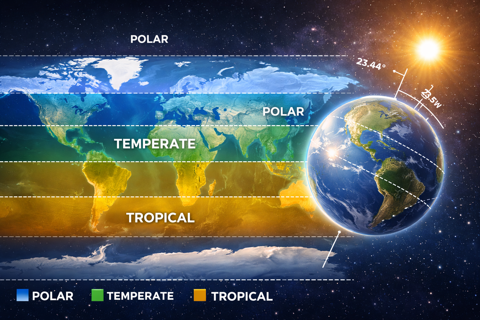
- Climatology – climate systems, weather patterns, and climate change
- Hydrology – movement and distribution of water
- Biogeography – spatial distribution of plants and animals
- Pedology (Soil Geography) – soil formation and classification
- Oceanography – physical and biological ocean processes
These subfields help scientists understand natural hazards, ecosystem dynamics, and long-term environmental change. Academic consensus summarized by Wikipedia and reinforced by NASA and USGS research shows that modern physical geography increasingly operates within an Earth system science framework, where atmosphere, biosphere, hydrosphere, and lithosphere are studied as interconnected systems.
Why Physical Geography Matters
Physical geography is essential for:
- Predicting climate-related risks (floods, droughts, sea-level rise)
- Managing water and soil resources
- Preserving biodiversity and ecosystems
- Supporting disaster preparedness and mitigation
Today, satellite imagery, remote sensing, and climate models are widely used to generate high-resolution environmental data, improving the accuracy of environmental forecasts.
2. Human Geography
Human geography examines the spatial organization of human populations, cultures, economies, and political systems. It explores how human activities shape places—and how places shape human behavior.
Key Subfields of Human Geography
Human geography includes:
- Population Geography – demographics, migration, and settlement patterns
- Cultural Geography – language, religion, identity, and cultural landscapes
- Economic Geography – industry, trade, globalization, and development
- Political Geography – borders, geopolitics, and governance
- Urban Geography – city growth, housing, and infrastructure
- Health & Medical Geography – spatial patterns of health and disease
Institutions such as the Association of Environmental & Engineering Studies (AEES) and university geography departments emphasize that modern human geography blends quantitative spatial analysis with qualitative fieldwork, interviews, and ethnographic research.
Why Human Geography Is Important
Human geography helps policymakers and planners address:
- Rapid urbanization and housing shortages
- Migration and refugee crises
- Unequal access to healthcare, education, and jobs
- Cultural integration and regional identity
In my experience analyzing geographic educational content, human geography stands out for its ability to translate spatial data into social insight, making it especially valuable for development planning and public policy.
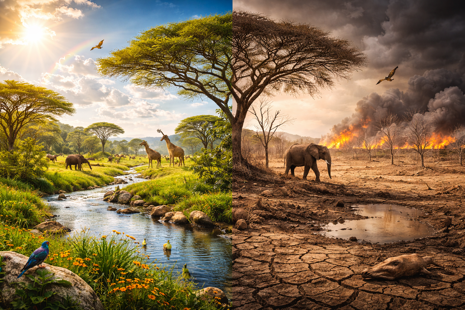
3. Environmental Geography
Environmental geography bridges physical and human geography by focusing on human–environment interactions. It asks how human activities affect natural systems—and how environmental change affects societies.
Core Areas of Study
Environmental geographers study:
- Human impacts such as deforestation, pollution, and land degradation
- Environmental policy, governance, and sustainability
- Environmental justice and inequality
- Coupled human–natural systems and feedback loops
According to National Geographic Education, this branch draws heavily from ecology, economics, political science, and sociology to provide integrated solutions to environmental problems.
Why Environmental Geography Is Crucial Today
With climate change, biodiversity loss, and resource depletion accelerating, environmental geography plays a key role in:
- Climate adaptation and resilience planning
- Sustainable land-use management
- Designing fair environmental policies
- Balancing development with conservation
This branch is especially relevant for careers in sustainability, climate policy, and conservation planning.
4. Technical Geography (Geospatial Geography)
Technical geography, also known as geospatial geography or geomatics, focuses on the tools and technologies used to collect, analyze, and visualize spatial data.
Main Components
Technical geography includes:
- Geographic Information Systems (GIS)
- Remote Sensing (satellite and aerial imagery)
- Global Positioning Systems (GPS)
- Spatial modeling and predictive analytics
Unlike other branches, technical geography is defined by methodology rather than subject matter. As outlined by Wikipedia and academic GIS literature, it underpins nearly all modern geographic research.
Why Technical Geography Is Growing Rapidly
Geospatial technologies are now essential in:
- Urban and regional planning
- Disaster response and emergency management
- Environmental monitoring
- Transportation and logistics
- Business location analysis
Advances in AI, machine learning, and geospatial knowledge graphs—discussed in recent arXiv research—are transforming geography into a highly data-driven science.
How the Branches of Geography Work Together
Modern geographic research is rarely confined to a single branch. For example:
- Climate change studies combine physical, human, and environmental geography
- Disease mapping relies on health geography and GIS
- Urban sustainability planning blends human geography, environmental analysis, and geospatial tools
This integration has produced hybrid fields such as political ecology, transport geography, and health geography, reflecting geography’s adaptability to complex global challenges.
Current Trends in Geographic Research
Contemporary geography increasingly focuses on:
- Big data and spatial analytics
- Climate adaptation and resilience
- Migration and urban vulnerability
- AI-driven geospatial modeling
Research institutions worldwide emphasize interdisciplinary collaboration, confirming geography’s role as a forward-looking, problem-solving discipline.
Why Geography Still Matters
Geography provides the spatial perspective needed to understand today’s interconnected world. Whether analyzing climate systems, urban growth, environmental sustainability, or technological innovation, geography equips researchers, planners, and policymakers with tools to make informed decisions.
Understanding the four major branches of geography reveals how the discipline connects science, society, and space—and why it remains essential for navigating the challenges of the 21st century.
Incredible quest there. What happdned after? Thanks!
my webpage öksürüğe ne iyi gelir